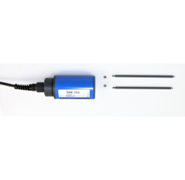
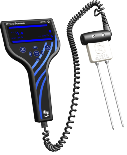
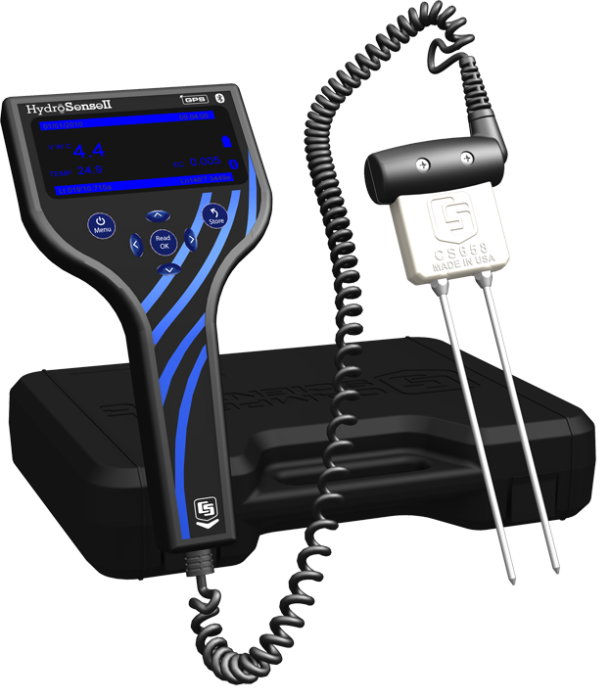
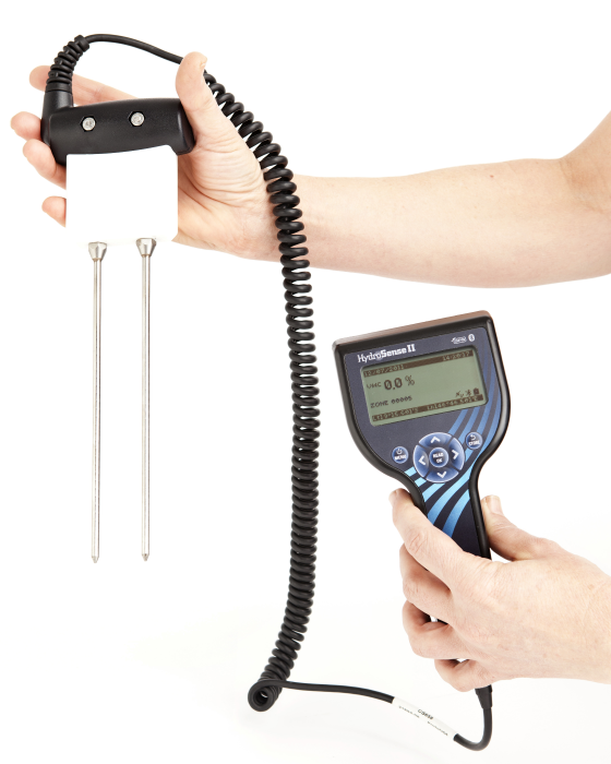
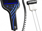
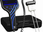
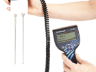

The HS2 is the handheld display for the new Hydrosense II soil-water sensor. When paired with either the CS658 or CS659 portable soil-water probes, it replaces the previous Hydrosense soil-water system. It features a new handheld display and a new probe design. The HS2 handheld has been designed to be compact and portable, with the layout of the buttons allowing for operation with one hand.
Handheld Display
The display consists of a three-inch LCD and four navigation buttons that make changing settings and taking measurements as easy as possible. Integrated GPS tags each measurement with a latitude and longitude.
Zones can be created on the unit in which group measurements together so that average soil moisture can be calculated for an area. The current position and zone are shown on the display so that measurements can be taken in the same zone.
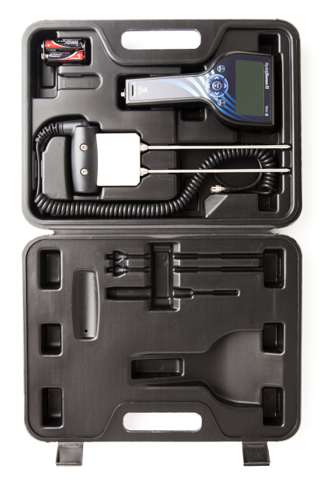
Data storage has been added to allow more than 1000 measurements to be stored on the device. The data can then be downloaded to a PC via Bluetooth for viewing and archiving.
Soil Moisture Probe
The new soil moisture probe uses the same accurate measurement technique as the old probe, but the probe housing has been redesigned to aid insertion into and removal from hard soils. The probe rods are secured to the probe housing with ferrule nuts to provide extra stability during insertion. A moulded plastic grip connects the sensor cable to housing to provide better grip.
Software
New PC software has been developed to make the most of the data storage capability of the HS2. The software connects to the HS2 via Bluetooth to avoid the need for extra cables.
The software allows the user to:
- View data in table and chart views
- Edit zone positions and sizes
- Change device settings
- Export data to CSV to interface with 3rd party software
- View zones and measurements in Google Earth
Benefits and Features
- Compact and lightweight
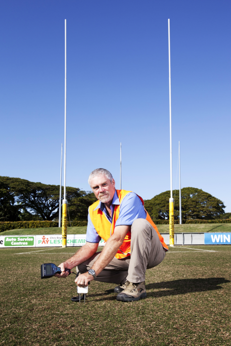
- Read real-time soil-water content measurements in the field
- Large LCD display for easy operation
- Onboard data storage for up to 1500 points
- Onboard GPS for geotagging measurements
- Bluetooth connection to PC software
- Export to Google Earth, GPX and CSV
- Probe redesign for easy insertion and removal from soil
| Measurements Made | Volumetric water content (VWC) of porous media (such as soil) |
| Required Equipment | HS2 is a complete system. |
| Soil Suitability | Short rods are easy to install in hard soil. Suitable for soils with higher electrical conductivity. |
| Rods | Replaceable |
| Sensors | Interchangeable sensors; can swap the 12 cm and 20 cm sensors with the reader. |
Handheld Display |
|
| Display | 128 x 64 pixel graphic LCD |
| Backlight | Blue and white LED (brightness-adjustable) |
| GPS Accuracy |
|
| Bluetooth Range | ~10 m (~30 ft) |
| Data Storage | > 1000 records (ring memory) |
| Zone Storage | > 100 records |
| Power Supply | 6 Vdc, 4 AA batteries |
| Battery Life | 6 to 12 months (typical usage) |
| Dimensions | 200 x 100 x 58 mm (7.9 x 3.9 x 2.3 in.) |
| Weight | 340 g (12 oz) |