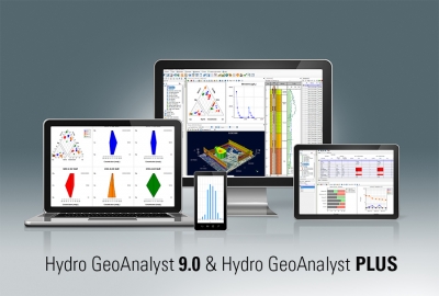
- Environmental Data Management, Analysis and Visualization Software
- Hydro GeoAnalyst all-in-one groundwater and environmental data management software that integrates a complete range of easy-to-use analysis and reporting tools, with a powerful yet flexible SQL Server database technology.
- User can expect the highest level of performance and a completely scalable solution to meet their groundwater and environmental project demands.
- An all-in-one desktop concept that provides one-click access to many powerful features (e.g. Data Transfer System, Query Editor, GIS Map Manager, 2D Cross-Section Editor, 3D-Explorer, Template Manager, Report Editor, and much more!)
Environmental Data Management, Analysis and Visualization Software
Hydro GeoAnalyst is the all-in-one groundwater and environmental data management system that stores and organizes environmental data, and helps you quickly create comprehensive analytical results that are reliable and easy to understand.
With Hydro GeoAnalyst, environmental professionals, geoscientists and government agencies have all the tools required to effectively and efficiently manage large volumes of data, and make informed decisions about environmental and water resources.
HGA consists of an application that connects to an SQL Server database and facilitates data management, analysis and interpretation, and collaboration through various purpose-built modules. HGA helps you work with large volumes of environmental data without requiring in-depth knowledge of SQL. HGA+ extends these capabilities by adding modules specifically designed to work with geochemical data and a console for use R to get even more out of your data.
- Manage data for local, state and federal groundwater monitoring networks
- Manage data associated with remediation projects
- Manage well construction details and registration information
- Analyze borehole data acquired for mineral exploration
- Interpret geologic and hydrostratigrpahic data
- Mapping and reporting of aquifer extents and geologic formations
- Store and report landfill monitoring data
- Evaluate and report the spatial distribution of water quality parameters
- Groundwater vulnerability assessment and protection planning
Save time and money
Increase efficiency and achieve cost savings with streamlined and automated data collection, data import, analysis and reporting workflows.
Improve data quality
Hydro GeoAnalyst standardizes your organization and intelligently validates all data upon import, ensuring it meets quality requirements for reliable analyses and informed decision making.
Get started fast
Hydro GeoAnalyst helps you kick start your project by providing an environmental database template that consist of tables and fields for common environmental data types, common well profile templates and report templates.
Always be in control
Unlike other commercial environmental data management software packages, Hydro GeoAnalyst gives you complete control over your database, allowing you to fully customize the database structure to accommodate project needs and scale your database as data volumes grow.
Gain critical insight
Gain greater insight into your environmental data with a suite of integrated analysis, interpretation and visualization tools including Map Manager, Cross Section Editor, Well Profile, Time Series Charts, Scene Viewer and more. Unlike other commercial data management systems, the analysis tools included with Hydro GeoAnalyst are developed solely by Waterloo Hydrogeologic which saves you money, guarantees interoperability, and simplifies procurement and license management.
Keep vital information at your fingertips
The Query Builder is a powerful tool that helps you create, save and recall simple to complex data queries without having to know complicated SQL syntax. Easily define the conditions of your query by dragging and dropping database fields, and choosing the desired logical operators (AND, OR, LIKE and IS).
Collaborate and communicate efficiently
Hydro GeoAnalyst stores all your data in a single, centralized database that can be accessed securely by multiple users across a network. Well Profiles, maps, cross-section diagrams, time-series charts and reports can be easily retrieved by team members and key decision makers.
Maximize efficiency in the field
Hydro GeoAnalyst streamlines field data collection with easy-to-use planning tools and support for mobile electronic data deliverables. Easily plan and schedule your field trips, and then conveniently collect your data using your Apple or Android mobile device.