SpectroSense 2 GPS
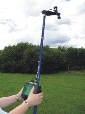
SpectroSense2+.gps has all the features and functionality of SpectroSense2+, but with the addition GPS. Being able to record latitude & longitude at the same time as the light readings enable true field mapping. Data can be imported into proprietary 3D Graphing Software to produce very realistic maps of land use, crop cover, etc.
The GPS module is small & unobtrusive (approx. 45x45x6mm) and, when used with the hand-held pole, will locate on the top of the pole. No subscription is required and the resolution is typically 3 metres. 1 metre is possible in SBAS areas.