WETEC

Rainfall and Flood Monitoring System

Accurate, traceable rainfall measurement for meteorology, agriculture, hydrology, and research. Extended into flood early warning with water level and flow integration.

Rain Flood

Every Hydrological Decision Starts With a Rainfall Number

Rainfall is the headline number in almost every applied earth science. Agronomists use it to plan irrigation and time fertilizer. Hydrologists use it to model runoff, recharge groundwater, and forecast river response. Meteorologists use it to verify forecasts and study climate trends. Engineers use it to size drainage, validate storm return periods, and defend insurance claims. And when rainfall is the trigger for a flash flood, the same number becomes the input to an early warning system that has to act within minutes.

Yet rainfall is one of the harder atmospheric parameters to measure well. A gauge that is poorly sited, wrongly sized, or never calibrated produces data that quietly biases every downstream calculation. A network spaced too thinly misses the very rainfall cells that cause the largest impacts. A gauge that reports correctly at 10 mm per hour can be 30 percent off at 200 mm per hour, which is the rate that actually matters in a flash flood.

Wetec supply, installs, and maintains rainfall measurement systems built around WMO-class instruments, calibrated and sited to give defensible data for the application that depends on them. The same network extends naturally into flood early warning by adding water level, flow, and automated alerting at the locations where the rainfall consequences actually arrive.
Types of Measurements

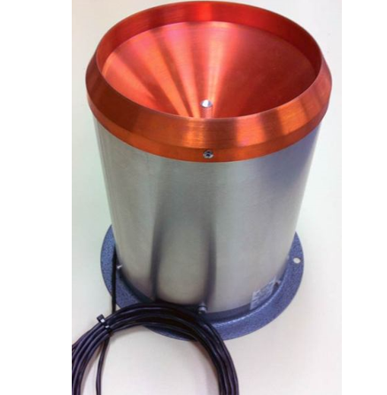
  • Tipping bucket rain gauges: Reliable, low-power, and well suited to networked deployments. Wetec supplies WMO-class gauges with 0.1 mm and 0.2 mm resolution, with siphon for high-intensity tropical rainfall and cold-climate sites.

  • Weighing rain gauges: the reference standard for highest accuracy and the only practical method for measuring all forms of precipitation, including snow, sleet, and mixed events. Used for reference stations, snow-dominated sites, and any installation where rainfall data must be traceable to national standards.

  • Optical disdrometers: laser-based instruments that measure not just rainfall depth but also drop size distribution, drop velocity, and precipitation type. The right choice for radar calibration, hydrometeor research, and any application where rainfall microphysics matter.

  • Drop counter and acoustic gauges: compact, low-power gauges for dense urban networks where a tipping bucket is overkill and a low-cost indicative measurement is enough for spatial coverage.

  • Rainfall intensity reporting: all gauges configured to report accumulated depth, one-minute intensity, and configurable intensity classes. The intensity figures, not the daily totals, are what drive flood warnings, urban drainage design, and agricultural runoff models.

  • Water level (river, canal, drain, reservoir): pressure transducers, radar level sensors, ultrasonic gauges, and bubblers depending on site conditions. Radar is preferred for flood-prone installations where the sensor must stay above debris flow.

  • Flow rate and discharge: area-velocity sensors and ADCP-based instruments for rivers and large channels, electromagnetic and ultrasonic flow meters for pipes and culverts.

  • Soil moisture and groundwater context: distributed soil moisture and water table sensors supporting flood risk forecasting in catchments where antecedent conditions drive the response.

  • Communication and alerting: cellular as the primary path with satellite, radio, or LoRa backup, configurable alert rules sending SMS, email, dashboard alerts, and webhook calls to downstream systems.

Where It Is Used

  • National and regional meteorological rainfall networks
  • Agricultural rainfall monitoring for plantations, farms, and irrigation scheduling
  • Hydrological research and catchment studies
  • Urban drainage and stormwater design verification
  • Climate research and long-term precipitation records
  • Municipal and city flood early warning systems
  • Dam, reservoir, and barrage inflow monitoring
  • Road, highway, and tunnel safety networks
  • Construction sites with flood risk exposure
  • Disaster response and emergency management agencies

Frequently Asked Questions

Tipping bucket gauges are the right choice for most operational networks. They are reliable, low-power, easy to maintain, and well-understood. Weighing gauges are the reference standard for the highest accuracy and for sites with snow or mixed precipitation. Optical disdrometers are the right choice when rainfall type and drop size distribution matter, for example radar calibration or hydrometeor research. Wetec advises on the right type based on accuracy class, climate, and the downstream use of the data.